Document

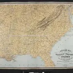
Military Map of the Middle and Southern States
Military Map of the Middle and Southern States, showing the Seat of War during the Great Rebellion in 1861. Drawn and engraved by J. Schedler. This map, published by Schaus, shows the majority of the Confederate states and the Border States of the Union. The map lists the major cities and towns as well as the railroad links across the country.
The British Library1863

