Document

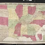
Phelps & Watson's Historical and Military Map of the Border and Southern States.
Phelps & Watson's Historical and Military Map of the Border and Southern States. This map, produced in New York in 1863 shows all the Confederate states, including a sizable amount of Texas, as well as the Border States of the Union. It is noteworthy that by this point in the war, Virginia has split into to, with the western half seceding from the rest of the state. West Virginia was admitted to the Union in 1863 and the map clearly shows the separation. The map also contains a list of the major battles from 1861 and 1862 in the bottom right hand corner.
The British Library1863

