Maps of Bila Tserkva
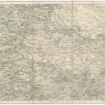 1875|Militärgeographisches Institut1:300 000
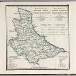 1829|Piadyshev, Vasilii Petrovich, 1758-18351:1 066 000
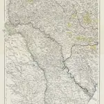 1850|entworfen und gezeichnet von F. Handtke1:900 000
 1819|Gleditsch1:1 637 000
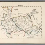 1829|Hermann, O.1:500 000
 1837|Schubert, Friedrich Theodor1:1 400 000
 1849|Handtke, Friedrich1:1 863 880
Old maps of Bila Tserkva
Discover the past of Bila Tserkva on historical maps
Old maps of Bila Tserkva
Discover the past of Bila Tserkva on historical maps
Looking for a Google Maps API Alternative?